
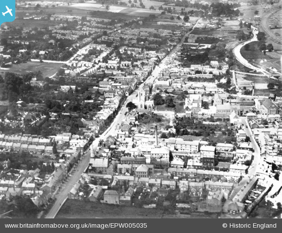
EPW005035 ENGLAND (1920). The High Street, Berkhamsted, 1920. This image has been produced from a print.
© Copyright OpenStreetMap contributors and licensed by the OpenStreetMap Foundation. 2026. Cartography is licensed as CC BY-SA.
Nearby Images (10)
EPW005035

EPW005037

EPW005032

EPW056456

EPW005239

EPW056457

EPW056454

EPW021329

EPW056455

EPW022500

Details
| Title | [EPW005035] The High Street, Berkhamsted, 1920. This image has been produced from a print. |
| Reference | EPW005035 |
| Date | July-1920 |
| Link | |
| Place name | BERKHAMSTED |
| Parish | BERKHAMSTED |
| District | |
| Country | ENGLAND |
| Easting / Northing | 499381, 207744 |
| Longitude / Latitude | -0.55990672523146, 51.759099508838 |
| National Grid Reference | SP994077 |
