
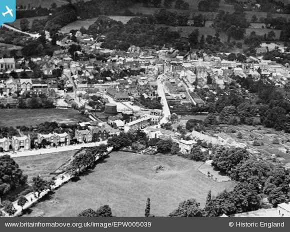
EPW005039 ENGLAND (1920). The town, Buckingham, 1920. This image has been produced from a copy-negative.
© Copyright OpenStreetMap contributors and licensed by the OpenStreetMap Foundation. 2026. Cartography is licensed as CC BY-SA.
Nearby Images (10)
EPW005039

EPW005043

EAW015426

EAW015425

EAW015424

EAW015427

EPW005040

EAW048983

EPW005042

EAW015428

Details
| Title | [EPW005039] The town, Buckingham, 1920. This image has been produced from a copy-negative. |
| Reference | EPW005039 |
| Date | July-1920 |
| Link | |
| Place name | BUCKINGHAM |
| Parish | BUCKINGHAM |
| District | |
| Country | ENGLAND |
| Easting / Northing | 469686, 233801 |
| Longitude / Latitude | -0.98485531881318, 51.99784912056 |
| National Grid Reference | SP697338 |
Pins
Be the first to add a comment to this image!