
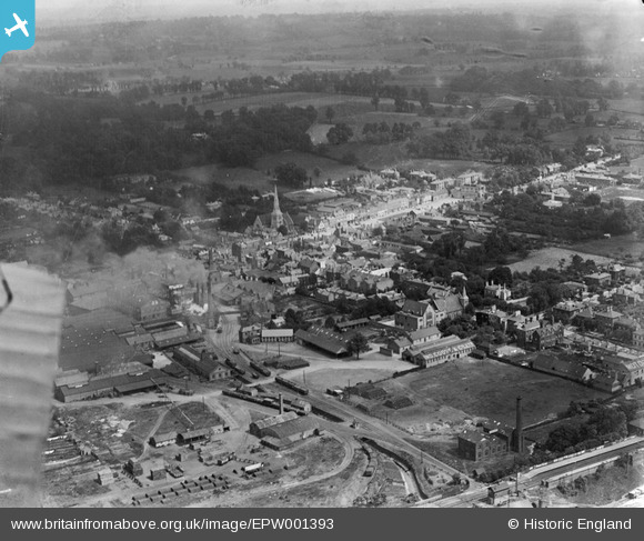
EPW001393 ENGLAND (1920). General view of the town centre, Romford, from the south, 1920
© Copyright OpenStreetMap contributors and licensed by the OpenStreetMap Foundation. 2026. Cartography is licensed as CC BY-SA.
Nearby Images (2)
EPW001393

EPW001405

Details
| Title | [EPW001393] General view of the town centre, Romford, from the south, 1920 |
| Reference | EPW001393 |
| Date | 7-June-1920 |
| Link | |
| Place name | ROMFORD |
| Parish | |
| District | |
| Country | ENGLAND |
| Easting / Northing | 551193, 188602 |
| Longitude / Latitude | 0.18210977949228, 51.575504565311 |
| National Grid Reference | TQ512886 |
Pins

hillman34 |
Wednesday 5th of June 2013 10:32:17 PM | |

Maurice |
Sunday 24th of March 2013 10:25:54 PM | |

Class31 |
Tuesday 30th of October 2012 09:03:40 AM | |
|
Class31 |
Tuesday 30th of October 2012 09:02:59 AM | |
|
Class31 |
Tuesday 30th of October 2012 09:01:38 AM | |
|
Class31 |
Tuesday 30th of October 2012 09:00:55 AM |