
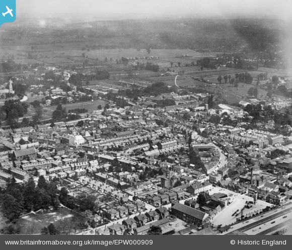
EPW000909 ENGLAND (1920). King Street and environs, Maidenhead, from the south-west, 1920. This image has been produced from a copy-negative.
© Copyright OpenStreetMap contributors and licensed by the OpenStreetMap Foundation. 2026. Cartography is licensed as CC BY-SA.
Nearby Images (7)
EPW000909

EPW000907

EPW022623

EPW022621

EAW026480

EPW022624

EPW000905

Details
| Title | [EPW000909] King Street and environs, Maidenhead, from the south-west, 1920. This image has been produced from a copy-negative. |
| Reference | EPW000909 |
| Date | May-1920 |
| Link | |
| Place name | MAIDENHEAD |
| Parish | |
| District | |
| Country | ENGLAND |
| Easting / Northing | 488735, 180949 |
| Longitude / Latitude | -0.72092586778738, 51.519999937498 |
| National Grid Reference | SU887809 |
Pins
Be the first to add a comment to this image!