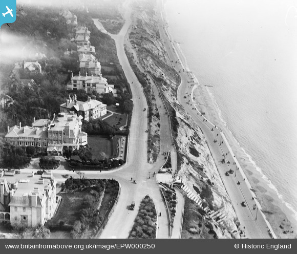
EPW000250 ENGLAND (1920). East Cliff, Bournemouth, 1920
© Copyright OpenStreetMap contributors and licensed by the OpenStreetMap Foundation. 2026. Cartography is licensed as CC BY-SA.
Nearby Images (8)
EPW000250

EPR000659

EAW034623

EAW002995

EPW000276

EPW018152

EPW000279

EAW018155

Details
| Title | [EPW000250] East Cliff, Bournemouth, 1920 |
| Reference | EPW000250 |
| Date | April-1920 |
| Link | |
| Place name | BOURNEMOUTH |
| Parish | |
| District | |
| Country | ENGLAND |
| Easting / Northing | 409682, 90979 |
| Longitude / Latitude | -1.8628371710399, 50.717784011085 |
| National Grid Reference | SZ097910 |
Pins

Class31 |
Tuesday 15th of July 2014 07:38:46 AM | |
|
Class31 |
Tuesday 15th of July 2014 07:34:11 AM | |

Peter Kazmierczak |
Wednesday 18th of September 2013 11:01:35 AM | |
|
Peter Kazmierczak |
Wednesday 18th of September 2013 11:01:16 AM | |
|
Peter Kazmierczak |
Wednesday 18th of September 2013 11:00:43 AM | |
|
Peter Kazmierczak |
Wednesday 18th of September 2013 11:00:23 AM | |
|
Peter Kazmierczak |
Wednesday 18th of September 2013 10:59:41 AM |