
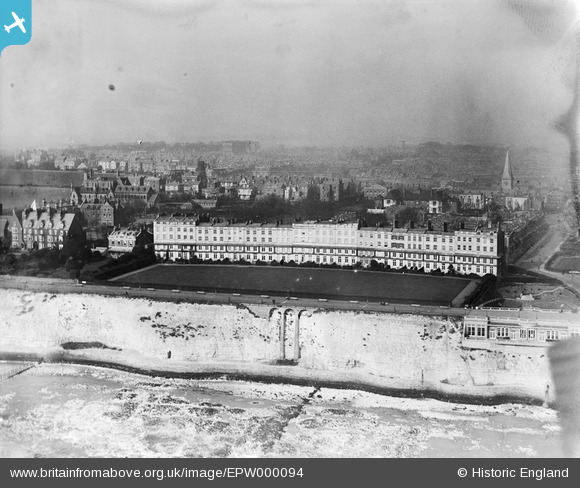
EPW000094 ENGLAND (1920). The Royal Crescent, Ramsgate, 1920
© Copyright OpenStreetMap contributors and licensed by the OpenStreetMap Foundation. 2026. Cartography is licensed as CC BY-SA.
Nearby Images (12)
EPW000094

EAW009023

EPW000081

EPW000090

EPW000601

EPW013301

EPW000097

EPW035451

EPW052895

EAW009024

EAW009025

EPW052885

Details
| Title | [EPW000094] The Royal Crescent, Ramsgate, 1920 |
| Reference | EPW000094 |
| Date | February-1920 |
| Link | |
| Place name | RAMSGATE |
| Parish | RAMSGATE |
| District | |
| Country | ENGLAND |
| Easting / Northing | 637810, 164405 |
| Longitude / Latitude | 1.4139970016789, 51.328429468275 |
| National Grid Reference | TR378644 |
Pins

Gen_Hancock |
Thursday 9th of February 2017 12:07:29 PM | |
|
Croxley history |
Thursday 23rd of August 2012 11:05:08 PM | |
designed by Gilbert Scot opened in August 1847 |
Croxley history |
Thursday 23rd of August 2012 11:08:48 PM |