
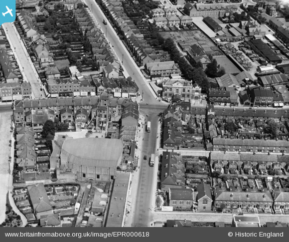
EPR000618 ENGLAND (1935). The junction of South Road and Lady Margaret Road, Southall, 1935
© Copyright OpenStreetMap contributors and licensed by the OpenStreetMap Foundation. 2025. Cartography is licensed as CC BY-SA.
Nearby Images (2)
EPR000618

EPR000606

Details
| Title | [EPR000618] The junction of South Road and Lady Margaret Road, Southall, 1935 |
| Reference | EPR000618 |
| Date | 9-June-1935 |
| Link | |
| Place name | SOUTHALL |
| Parish | |
| District | |
| Country | ENGLAND |
| Easting / Northing | 512816, 180379 |
| Longitude / Latitude | -0.37412614705802, 51.51057919979 |
| National Grid Reference | TQ128804 |
Pins

Leslie B |
Saturday 2nd of November 2019 12:28:45 AM | |
|
The Laird |
Thursday 28th of February 2019 02:17:44 AM | |

Des Elmes |
Sunday 10th of April 2016 10:25:30 PM | |
|
Mozzy |
Sunday 28th of December 2014 11:11:10 PM | |
|
Mozzy |
Sunday 28th of December 2014 11:06:18 PM | |
|
dave43 |
Wednesday 12th of November 2014 06:20:53 PM |