
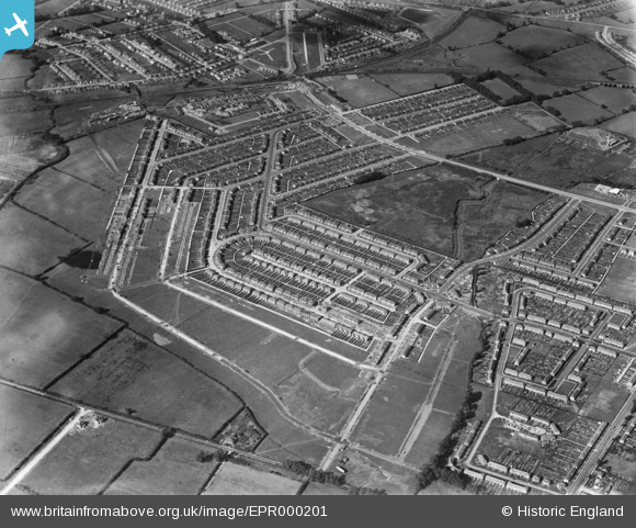
EPR000201 ENGLAND (1934). The Tithe Farm Housing Estate around Lulworth Gardens, South Harrow, 1934
© Copyright OpenStreetMap contributors and licensed by the OpenStreetMap Foundation. 2025. Cartography is licensed as CC BY-SA.
Nearby Images (7)
EPR000201

EPR000204

EPR000199

EPW046493

EPW046496

EPW046492

EPR000203

Details
| Title | [EPR000201] The Tithe Farm Housing Estate around Lulworth Gardens, South Harrow, 1934 |
| Reference | EPR000201 |
| Date | July-1934 |
| Link | |
| Place name | SOUTH HARROW |
| Parish | |
| District | |
| Country | ENGLAND |
| Easting / Northing | 512601, 186679 |
| Longitude / Latitude | -0.37520756468375, 51.567251741402 |
| National Grid Reference | TQ126867 |
Pins
Be the first to add a comment to this image!