
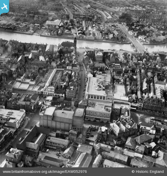
EAW052976 ENGLAND (1953). Regent Street and environs, Great Yarmouth, 1953
© Copyright OpenStreetMap contributors and licensed by the OpenStreetMap Foundation. 2026. Cartography is licensed as CC BY-SA.
Nearby Images (7)
EAW052976

EPW021191

EPW021192

EAW052972

EPW001879

EPW002003

EAW052975

Details
| Title | [EAW052976] Regent Street and environs, Great Yarmouth, 1953 |
| Reference | EAW052976 |
| Date | 19-November-1953 |
| Link | |
| Place name | GREAT YARMOUTH |
| Parish | |
| District | |
| Country | ENGLAND |
| Easting / Northing | 652416, 307536 |
| Longitude / Latitude | 1.728455096555, 52.606491222089 |
| National Grid Reference | TG524075 |
Pins

redmist |
Tuesday 18th of January 2022 09:00:21 PM | |
|
gBr |
Tuesday 22nd of November 2016 06:58:24 PM | |
|
John Frosdick |
Tuesday 15th of December 2015 05:31:24 AM | |
|
John Frosdick |
Tuesday 15th of December 2015 05:28:17 AM | |
|
John Frosdick |
Tuesday 15th of December 2015 05:26:51 AM | |
|
John Frosdick |
Thursday 26th of November 2015 06:27:00 AM | |
|
John Frosdick |
Thursday 26th of November 2015 06:25:55 AM | |
|
John Frosdick |
Thursday 26th of November 2015 06:23:59 AM | |
|
John Frosdick |
Thursday 26th of November 2015 06:22:36 AM | |
|
John Frosdick |
Thursday 26th of November 2015 06:21:59 AM | |
|
John Frosdick |
Thursday 26th of November 2015 06:21:24 AM | |
|
John Frosdick |
Thursday 26th of November 2015 06:20:38 AM | |
|
John Frosdick |
Thursday 26th of November 2015 06:19:54 AM | |
|
John Frosdick |
Thursday 26th of November 2015 06:17:32 AM |