
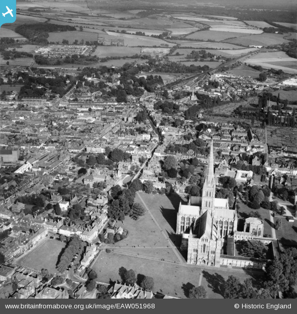
EAW051968 ENGLAND (1953). St Mary's Cathedral, North Walk and environs, Salisbury, 1953
© Copyright OpenStreetMap contributors and licensed by the OpenStreetMap Foundation. 2026. Cartography is licensed as CC BY-SA.
Nearby Images (10)
EAW051968

EAW051922

EAW025830

EAW051917

EPW011037

EAW051921

EPW041080

EAW003563

EAW025828
, Salisbury, 1949. This image has been produced from a damaged negative.")
EAW025827

Details
| Title | [EAW051968] St Mary's Cathedral, North Walk and environs, Salisbury, 1953 |
| Reference | EAW051968 |
| Date | 5-September-1953 |
| Link | |
| Place name | SALISBURY |
| Parish | SALISBURY |
| District | |
| Country | ENGLAND |
| Easting / Northing | 414573, 129647 |
| Longitude / Latitude | -1.7920047419386, 51.06543813589 |
| National Grid Reference | SU146296 |
Pins

nkingdon |
Sunday 30th of January 2022 10:12:31 PM | |
|
nkingdon |
Sunday 30th of January 2022 10:06:54 PM | |
|
nkingdon |
Sunday 30th of January 2022 10:01:03 PM | |
|
nkingdon |
Sunday 30th of January 2022 09:54:51 PM | |
|
nkingdon |
Sunday 30th of January 2022 09:49:53 PM | |
|
nkingdon |
Sunday 30th of January 2022 09:43:21 PM | |
|
nkingdon |
Sunday 30th of January 2022 09:41:56 PM |