
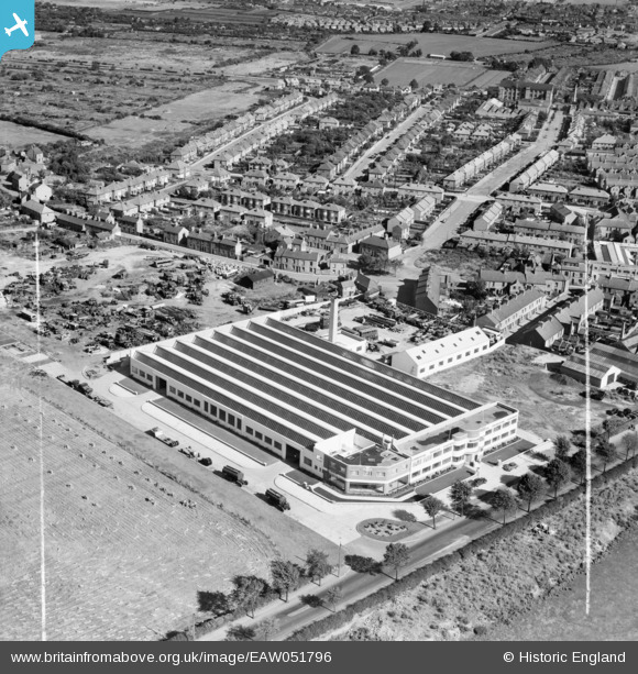
EAW051796 ENGLAND (1953). The Murphy Brothers Ltd Factory on Loughborough Road and environs, Rushey Mead, 1953. This image was marked by Aerofilms Ltd for photo editing.
© Copyright OpenStreetMap contributors and licensed by the OpenStreetMap Foundation. 2025. Cartography is licensed as CC BY-SA.
Nearby Images (9)
EAW051796

EAW051800

EAW051795

EAW051798

EAW051799

EAW051794

EAW051793

EAW051801

EAW051797

Details
| Title | [EAW051796] The Murphy Brothers Ltd Factory on Loughborough Road and environs, Rushey Mead, 1953. This image was marked by Aerofilms Ltd for photo editing. |
| Reference | EAW051796 |
| Date | 1-September-1953 |
| Link | |
| Place name | RUSHEY MEAD |
| Parish | |
| District | |
| Country | ENGLAND |
| Easting / Northing | 459369, 307490 |
| Longitude / Latitude | -1.1221085178735, 52.661526881837 |
| National Grid Reference | SK594075 |
Pins
Be the first to add a comment to this image!