
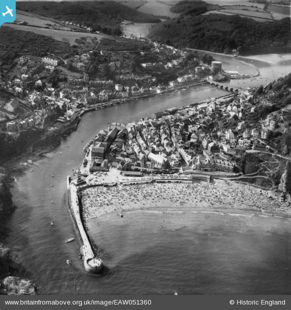
EAW051360 ENGLAND (1953). Looe Beach and the town, Looe, 1953
© Copyright OpenStreetMap contributors and licensed by the OpenStreetMap Foundation. 2026. Cartography is licensed as CC BY-SA.
Nearby Images (10)
EAW051360

EPW033112

EPW033109

EPW033113

EAW277527

EAW051356

EPW033108

EAW020277

EAW051357

EAW021374

Details
| Title | [EAW051360] Looe Beach and the town, Looe, 1953 |
| Reference | EAW051360 |
| Date | 11-August-1953 |
| Link | |
| Place name | LOOE |
| Parish | LOOE |
| District | |
| Country | ENGLAND |
| Easting / Northing | 225577, 53185 |
| Longitude / Latitude | -4.4521207293105, 50.352090550154 |
| National Grid Reference | SX256532 |
Pins

redmist |
Wednesday 16th of December 2020 10:04:43 AM | |
|
redmist |
Wednesday 16th of December 2020 10:00:02 AM | |
|
redmist |
Wednesday 16th of December 2020 09:58:34 AM | |
|
redmist |
Wednesday 16th of December 2020 09:57:11 AM |