
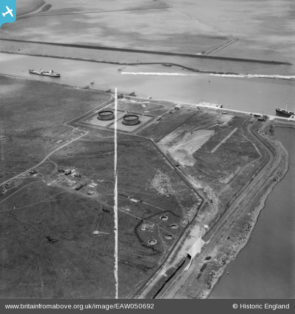
EAW050692 ENGLAND (1953). The Teesport Oil Depot and nearby gun emplacements, Teesport, 1953. This image was marked by Aerofilms Ltd for photo editing.
© Copyright OpenStreetMap contributors and licensed by the OpenStreetMap Foundation. 2026. Cartography is licensed as CC BY-SA.
Nearby Images (8)
EAW050692

EAW050693

EAW050694

EAW050687

EAW050688

EAW051066

EAW050695

EAW051067

Details
| Title | [EAW050692] The Teesport Oil Depot and nearby gun emplacements, Teesport, 1953. This image was marked by Aerofilms Ltd for photo editing. |
| Reference | EAW050692 |
| Date | 15-July-1953 |
| Link | |
| Place name | TEESPORT |
| Parish | |
| District | |
| Country | ENGLAND |
| Easting / Northing | 454242, 523022 |
| Longitude / Latitude | -1.160306399997, 54.599340022823 |
| National Grid Reference | NZ542230 |
Pins

Matt Aldred edob.mattaldred.com |
Monday 21st of July 2025 11:23:06 AM | |

redmist |
Sunday 28th of November 2021 04:23:00 PM | |
|
redmist |
Sunday 28th of November 2021 04:21:41 PM | |
|
redmist |
Monday 28th of October 2019 10:29:08 AM | |
|
redmist |
Monday 28th of October 2019 10:27:10 AM | |
|
cptpies |
Tuesday 7th of October 2014 08:02:41 AM | |
|
cptpies |
Tuesday 7th of October 2014 07:59:13 AM |
User Comment Contributions

HAA Battery Teeside. |
cptpies |
Tuesday 7th of October 2014 08:03:33 AM |