
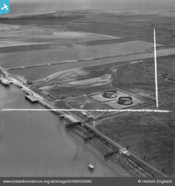
EAW050686 ENGLAND (1953). The Teesport Oil Depot and environs, Teesport, from the west, 1953. This image was marked by Aerofilms Ltd for photo editing.
© Copyright OpenStreetMap contributors and licensed by the OpenStreetMap Foundation. 2026. Cartography is licensed as CC BY-SA.
Nearby Images (7)
EAW050686

EAW050696

EAW050691

EAW050687

EAW051066

EAW050688

EAW050695

Details
| Title | [EAW050686] The Teesport Oil Depot and environs, Teesport, from the west, 1953. This image was marked by Aerofilms Ltd for photo editing. |
| Reference | EAW050686 |
| Date | 15-July-1953 |
| Link | |
| Place name | TEESPORT |
| Parish | |
| District | |
| Country | ENGLAND |
| Easting / Northing | 453907, 523041 |
| Longitude / Latitude | -1.165488265124, 54.599546629087 |
| National Grid Reference | NZ539230 |
Pins

redmist |
Monday 28th of October 2019 09:48:26 PM | |
|
redmist |
Monday 28th of October 2019 09:47:47 PM | |
|
redmist |
Monday 28th of October 2019 09:47:12 PM | |
|
redmist |
Monday 28th of October 2019 09:46:29 PM |