
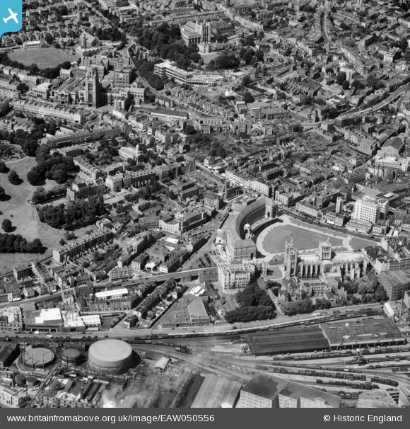
EAW050556 ENGLAND (1953). City Hall and environs, Bristol, 1953
© Copyright OpenStreetMap contributors and licensed by the OpenStreetMap Foundation. 2026. Cartography is licensed as CC BY-SA.
Nearby Images (25)
EAW050556

EAW002259

EAW052883

EAW052884

EAW052874

EAW052885

EPW012017

EPW005448

EPW005451

EPW005452

EPW005450

EPW005447

EPW005449

EAW002046

EPW022275

EAW050557

EPW005473

EPW005472

EPW005462

EPW047091

EPW008828

EAW002258

EAW000703

EAW000699

EPR000106

Details
| Title | [EAW050556] City Hall and environs, Bristol, 1953 |
| Reference | EAW050556 |
| Date | 9-July-1953 |
| Link | |
| Place name | BRISTOL |
| Parish | |
| District | |
| Country | ENGLAND |
| Easting / Northing | 358227, 172858 |
| Longitude / Latitude | -2.6012436473076, 51.452672856525 |
| National Grid Reference | ST582729 |
Pins

Frank |
Sunday 11th of August 2024 12:28:52 PM | |
|
Frank |
Sunday 11th of August 2024 12:22:19 PM | |
|
Frank |
Sunday 11th of August 2024 12:21:31 PM | |
|
Frank |
Sunday 11th of August 2024 12:19:46 PM |