
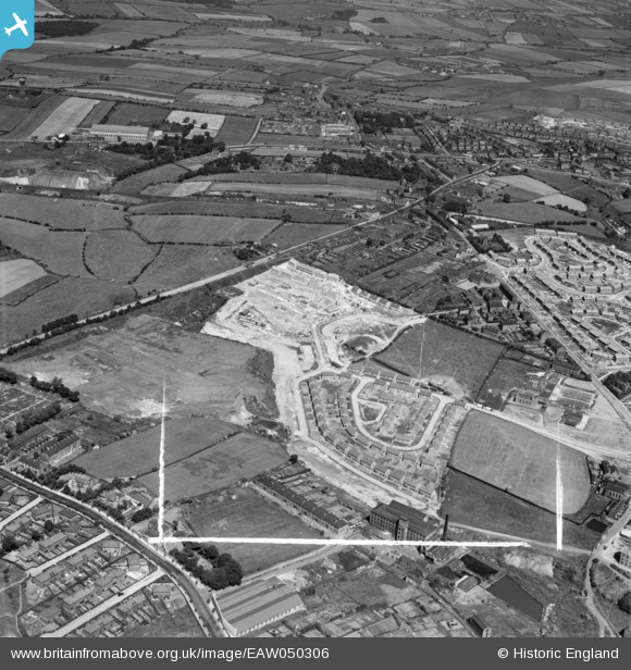
EAW050306 ENGLAND (1953). Housing estate under construction to the south of Wakefield Road, Dewsbury, 1953. This image was marked by Aerofilms Ltd for photo editing.
© Copyright OpenStreetMap contributors and licensed by the OpenStreetMap Foundation. 2026. Cartography is licensed as CC BY-SA.
Nearby Images (8)
EAW050306

EAW050309

EAW050305

EAW050302

EAW050304

EAW050308

EAW050303

EAW050307

Details
| Title | [EAW050306] Housing estate under construction to the south of Wakefield Road, Dewsbury, 1953. This image was marked by Aerofilms Ltd for photo editing. |
| Reference | EAW050306 |
| Date | 3-July-1953 |
| Link | |
| Place name | DEWSBURY |
| Parish | |
| District | |
| Country | ENGLAND |
| Easting / Northing | 426441, 421642 |
| Longitude / Latitude | -1.599551934286, 53.690329521251 |
| National Grid Reference | SE264216 |
Pins

Euan |
Friday 14th of April 2023 01:49:29 PM |