
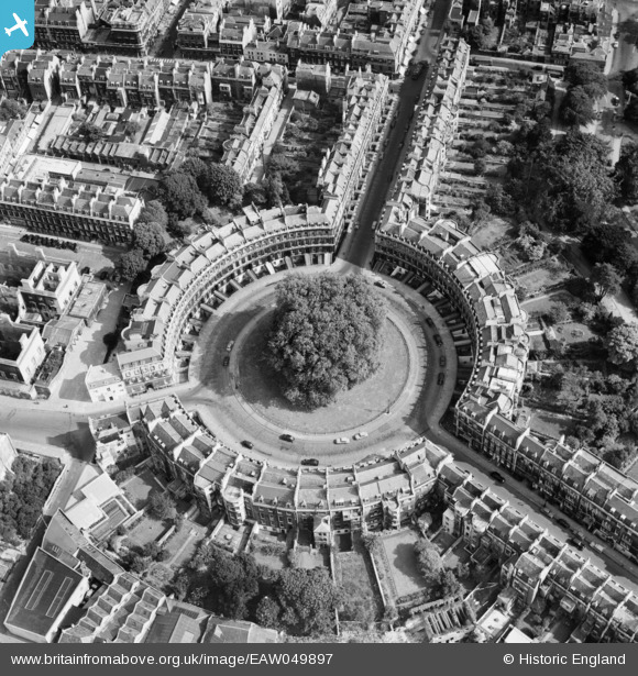
EAW049897 ENGLAND (1953). The Circus, Bath, 1953
© Copyright OpenStreetMap contributors and licensed by the OpenStreetMap Foundation. 2026. Cartography is licensed as CC BY-SA.
Nearby Images (17)
EAW049897

EPW001946

EAW049896

EPW053149

EPW001952

EPW048392

EAW026452

EPW053139

EAW049895

EAW000745

EPR000133

EPW033152

EAW026453

EAW000744

EPW053137

EAW027311

EPW053134

Details
| Title | [EAW049897] The Circus, Bath, 1953 |
| Reference | EAW049897 |
| Date | 12-June-1953 |
| Link | |
| Place name | BATH |
| Parish | |
| District | |
| Country | ENGLAND |
| Easting / Northing | 374766, 165270 |
| Longitude / Latitude | -2.3626623119092, 51.385417130406 |
| National Grid Reference | ST748653 |
Pins
Be the first to add a comment to this image!