
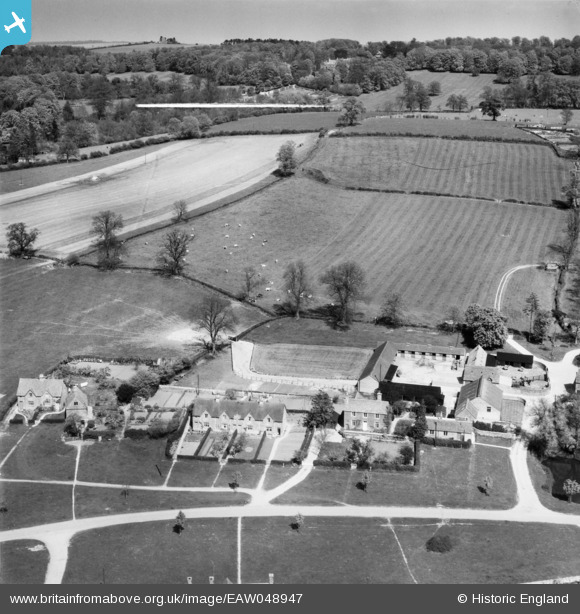
EAW048947 ENGLAND (1953). College Farm and environs, Wyck Rissington, 1953
© Copyright OpenStreetMap contributors and licensed by the OpenStreetMap Foundation. 2026. Cartography is licensed as CC BY-SA.
Nearby Images (14)
EAW048947

EAW048942

EAW045870

EAW045864

EAW045867

EAW045863

EAW048946

EAW045865

EAW048945

EAW045868

EAW048944

EAW048943

EAW045869

EAW045866

Details
| Title | [EAW048947] College Farm and environs, Wyck Rissington, 1953 |
| Reference | EAW048947 |
| Date | 5-May-1953 |
| Link | |
| Place name | WYCK RISSINGTON |
| Parish | WICK RISSINGTON |
| District | |
| Country | ENGLAND |
| Easting / Northing | 419015, 221839 |
| Longitude / Latitude | -1.7236408034147, 51.894338761198 |
| National Grid Reference | SP190218 |
Pins

totoro |
Thursday 11th of September 2014 06:53:01 PM | |
|
totoro |
Thursday 11th of September 2014 06:46:20 PM | |
|
totoro |
Thursday 11th of September 2014 06:44:29 PM |
User Comment Contributions
College Farmhouse is to the right of the duck pond and therefore not shown in this image. See instead the 1952 image EAW045865 |
totoro |
Thursday 11th of September 2014 06:45:28 PM |