
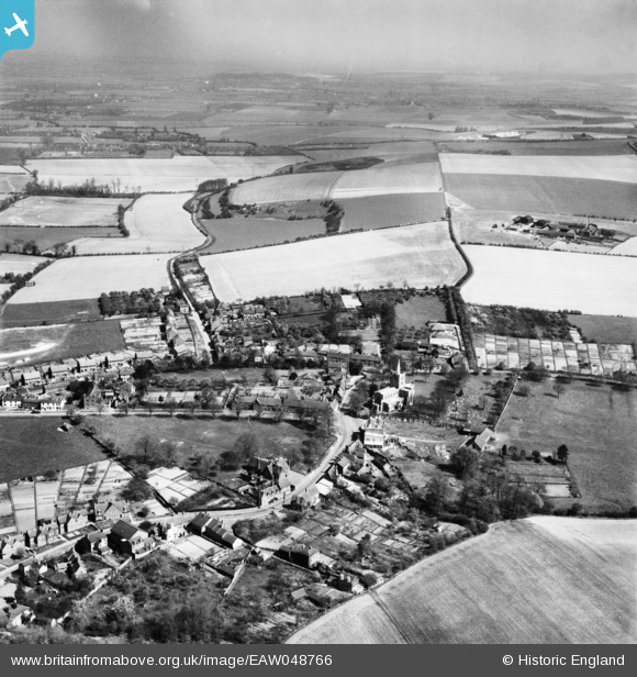
EAW048766 ENGLAND (1953). St Mary's Church, the village and the surrounding countryside, Ivinghoe, from the south-west, 1953
© Copyright OpenStreetMap contributors and licensed by the OpenStreetMap Foundation. 2026. Cartography is licensed as CC BY-SA.
Nearby Images (3)
EAW048766

EAW048768

EAW048765

Details
| Title | [EAW048766] St Mary's Church, the village and the surrounding countryside, Ivinghoe, from the south-west, 1953 |
| Reference | EAW048766 |
| Date | 22-April-1953 |
| Link | |
| Place name | IVINGHOE |
| Parish | IVINGHOE |
| District | |
| Country | ENGLAND |
| Easting / Northing | 494420, 216080 |
| Longitude / Latitude | -0.62950174140591, 51.834894400455 |
| National Grid Reference | SP944161 |
Pins

Dylan Moore |
Monday 20th of May 2019 05:47:56 PM |