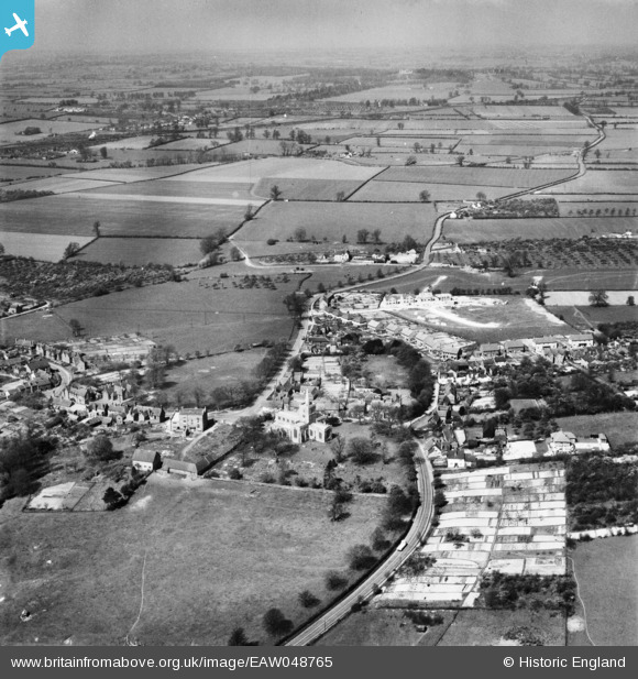
EAW048765 ENGLAND (1953). St Mary's Church, the village and the surrounding countryside, Ivinghoe, from the south-east, 1953
© Copyright OpenStreetMap contributors and licensed by the OpenStreetMap Foundation. 2026. Cartography is licensed as CC BY-SA.
Details
| Title | [EAW048765] St Mary's Church, the village and the surrounding countryside, Ivinghoe, from the south-east, 1953 |
| Reference | EAW048765 |
| Date | 22-April-1953 |
| Link | |
| Place name | IVINGHOE |
| Parish | IVINGHOE |
| District | |
| Country | ENGLAND |
| Easting / Northing | 494578, 216166 |
| Longitude / Latitude | -0.62718558200086, 51.83564075084 |
| National Grid Reference | SP946162 |
Pins

Dylan Moore |
Monday 20th of May 2019 05:41:52 PM | |

Dylan Moore |
Monday 20th of May 2019 05:39:55 PM | |

Dylan Moore |
Monday 20th of May 2019 05:38:14 PM | |

Dylan Moore |
Monday 20th of May 2019 05:35:39 PM | |

Dylan Moore |
Monday 20th of May 2019 05:34:52 PM | |

Dylan Moore |
Monday 20th of May 2019 05:33:31 PM |


![[EAW048765] St Mary's Church, the village and the surrounding countryside, Ivinghoe, from the south-east, 1953](http://britainfromabove.org.uk/sites/all/libraries/aerofilms-images/public/100x100/EAW/048/EAW048765.jpg)
![[EAW048768] St Mary's Church and the village, Ivinghoe, 1953](http://britainfromabove.org.uk/sites/all/libraries/aerofilms-images/public/100x100/EAW/048/EAW048768.jpg)
![[EAW048766] St Mary's Church, the village and the surrounding countryside, Ivinghoe, from the south-west, 1953](http://britainfromabove.org.uk/sites/all/libraries/aerofilms-images/public/100x100/EAW/048/EAW048766.jpg)