
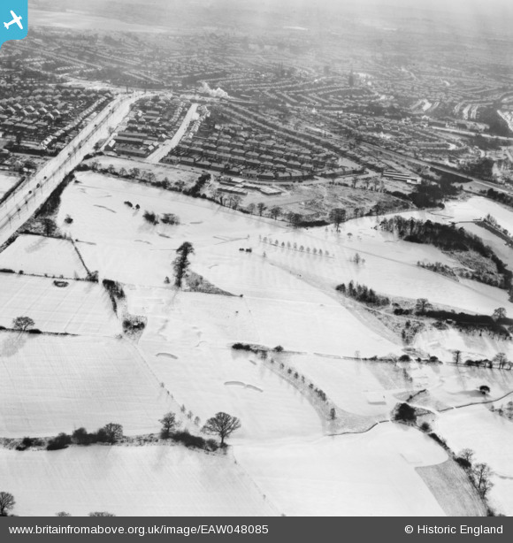
EAW048085 ENGLAND (1952). Mill Hill Golf Course under snow, Mill Hill, from the north, 1952
© Copyright OpenStreetMap contributors and licensed by the OpenStreetMap Foundation. 2026. Cartography is licensed as CC BY-SA.
Nearby Images (3)
EAW048085

EAW048083

EAW048084

Details
| Title | [EAW048085] Mill Hill Golf Course under snow, Mill Hill, from the north, 1952 |
| Reference | EAW048085 |
| Date | 15-December-1952 |
| Link | |
| Place name | MILL HILL |
| Parish | |
| District | |
| Country | ENGLAND |
| Easting / Northing | 520729, 193991 |
| Longitude / Latitude | -0.25546275607539, 51.631291454498 |
| National Grid Reference | TQ207940 |
Pins
Be the first to add a comment to this image!