
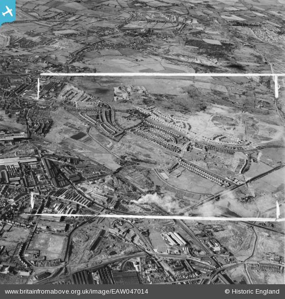
EAW047014 ENGLAND (1952). The residential area surrounding Morris Avenue under construction and environs, Bentley, 1952. This image was marked by Aerofilms Ltd for photo editing.
© Copyright OpenStreetMap contributors and licensed by the OpenStreetMap Foundation. 2025. Cartography is licensed as CC BY-SA.
Nearby Images (5)
EAW047014

EAW047012

EAW000779

EAW047015

EAW047011

Details
| Title | [EAW047014] The residential area surrounding Morris Avenue under construction and environs, Bentley, 1952. This image was marked by Aerofilms Ltd for photo editing. |
| Reference | EAW047014 |
| Date | 23-September-1952 |
| Link | |
| Place name | BENTLEY |
| Parish | |
| District | |
| Country | ENGLAND |
| Easting / Northing | 398225, 298429 |
| Longitude / Latitude | -2.0261999718446, 52.583309780327 |
| National Grid Reference | SO982984 |
Pins
Be the first to add a comment to this image!