
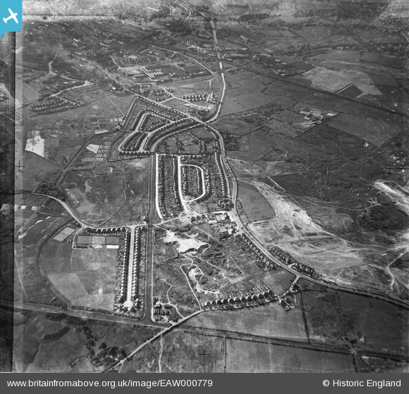
EAW000779 ENGLAND (1946). Wolverhampton Road, Pugh Crescent and environs, Bentley 1946
© Copyright OpenStreetMap contributors and licensed by the OpenStreetMap Foundation. 2025. Cartography is licensed as CC BY-SA.
Nearby Images (4)
EAW000779

EAW047014

EAW047011

EAW000770

Details
| Title | [EAW000779] Wolverhampton Road, Pugh Crescent and environs, Bentley 1946 |
| Reference | EAW000779 |
| Date | 11-May-1946 |
| Link | |
| Place name | BENTLEY |
| Parish | |
| District | |
| Country | ENGLAND |
| Easting / Northing | 398382, 298570 |
| Longitude / Latitude | -2.0238832551574, 52.584577979967 |
| National Grid Reference | SO984986 |
Pins

redmist |
Monday 10th of October 2022 09:01:23 PM | |
|
Bentleyboy |
Saturday 5th of April 2014 01:04:36 PM | |
|
Martin |
Wednesday 1st of January 2014 05:44:26 PM | |
|
Martin |
Wednesday 1st of January 2014 05:43:52 PM |