
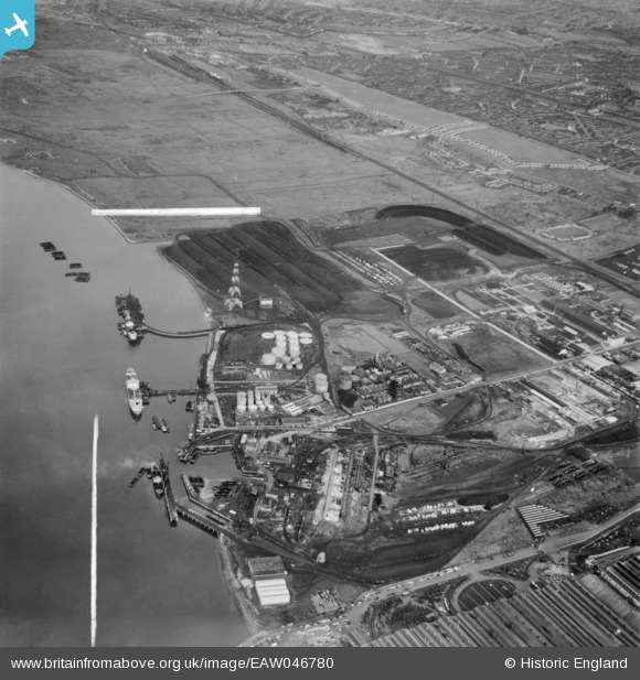
EAW046780 ENGLAND (1952). The jetties, depots and industrial premises at Horse Shoe Corner, Dagenham, 1952. This image was marked by Aerofilms Ltd for photo editing.
© Copyright OpenStreetMap contributors and licensed by the OpenStreetMap Foundation. 2026. Cartography is licensed as CC BY-SA.
Nearby Images (33)
EAW046780

EAW046778

EAW031160

EAW046771

EAW031163

EAW031159

EAW031166

EAW046775

EAW031165

EPW021395

EPW046552

EPW046547

EPW046548

EPW009946

EPW021391

EPW046515

EPW046553

EAW046774

EPW046615

EAW031164

EPW046550

EPW021396

EPW046549

EPW021394

EPW046613

EPW046614

EPW046612

EPW046546

EAW046777

EPW009947

EPW046551

EPW009951

EAW031156

Details
| Title | [EAW046780] The jetties, depots and industrial premises at Horse Shoe Corner, Dagenham, 1952. This image was marked by Aerofilms Ltd for photo editing. |
| Reference | EAW046780 |
| Date | 13-September-1952 |
| Link | |
| Place name | DAGENHAM |
| Parish | |
| District | |
| Country | ENGLAND |
| Easting / Northing | 548623, 182208 |
| Longitude / Latitude | 0.14234474473419, 51.518730749017 |
| National Grid Reference | TQ486822 |
Pins
Be the first to add a comment to this image!