
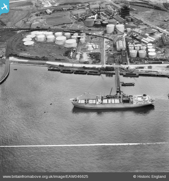
EAW046625 ENGLAND (1952). The Hudson Deep moored at Dagenham Dock, Dagenham, 1952. This image was marked by Aerofilms Ltd for photo editing.
© Copyright OpenStreetMap contributors and licensed by the OpenStreetMap Foundation. 2026. Cartography is licensed as CC BY-SA.
Nearby Images (35)
EAW046625

EAW046773

EAW046776

EAW046624

EPW021388

EAW031154

EAW046623

EAW046772

EPW021390

EPW021389

EPW059960

EPW021398

EPW059961

EAW046777

EPW046551

EPW059964

EPW009947

EPW046614

EPW059965

EPW059962

EAW046774

EPW059963

EPW046546

EPW059966

EAW031159

EPW059967

EAW031163

EAW046626

EAW031165

EAW031166

EPW021397

EAW046771

EPW021395

EAW031156

EPW009951

Details
| Title | [EAW046625] The Hudson Deep moored at Dagenham Dock, Dagenham, 1952. This image was marked by Aerofilms Ltd for photo editing. |
| Reference | EAW046625 |
| Date | 2-September-1952 |
| Link | |
| Place name | DAGENHAM |
| Parish | |
| District | |
| Country | ENGLAND |
| Easting / Northing | 548643, 181839 |
| Longitude / Latitude | 0.14247717121272, 51.515409582343 |
| National Grid Reference | TQ486818 |
Pins
Be the first to add a comment to this image!