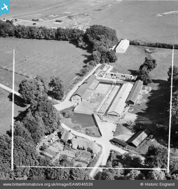
EAW046536 ENGLAND (1952). Lower House Farm, Everleigh, 1952. This image was marked by Aerofilms Ltd for photo editing.
© Copyright OpenStreetMap contributors and licensed by the OpenStreetMap Foundation. 2025. Cartography is licensed as CC BY-SA.
Nearby Images (8)
Details
| Title | [EAW046536] Lower House Farm, Everleigh, 1952. This image was marked by Aerofilms Ltd for photo editing. |
| Reference | EAW046536 |
| Date | 29-August-1952 |
| Link | |
| Place name | EVERLEIGH |
| Parish | EVERLEIGH |
| District | |
| Country | ENGLAND |
| Easting / Northing | 420843, 153280 |
| Longitude / Latitude | -1.7011457626069, 51.277773639662 |
| National Grid Reference | SU208533 |
Pins
Be the first to add a comment to this image!


![[EAW046536] Lower House Farm, Everleigh, 1952. This image was marked by Aerofilms Ltd for photo editing.](http://britainfromabove.org.uk/sites/all/libraries/aerofilms-images/public/100x100/EAW/046/EAW046536.jpg)
![[EAW046535] Lower House Farm, Everleigh, 1952. This image was marked by Aerofilms Ltd for photo editing.](http://britainfromabove.org.uk/sites/all/libraries/aerofilms-images/public/100x100/EAW/046/EAW046535.jpg)
![[EAW046534] Lower House Farm, Everleigh, 1952. This image was marked by Aerofilms Ltd for photo editing.](http://britainfromabove.org.uk/sites/all/libraries/aerofilms-images/public/100x100/EAW/046/EAW046534.jpg)
![[EAW046537] Lower House Farm, Everleigh, 1952. This image was marked by Aerofilms Ltd for photo editing.](http://britainfromabove.org.uk/sites/all/libraries/aerofilms-images/public/100x100/EAW/046/EAW046537.jpg)
![[EAW046538] Lower House Farm, Everleigh, 1952. This image was marked by Aerofilms Ltd for photo editing.](http://britainfromabove.org.uk/sites/all/libraries/aerofilms-images/public/100x100/EAW/046/EAW046538.jpg)
![[EAW046540] Lower House Farm, Everleigh, 1952. This image was marked by Aerofilms Ltd for photo editing.](http://britainfromabove.org.uk/sites/all/libraries/aerofilms-images/public/100x100/EAW/046/EAW046540.jpg)
![[EAW046539] Lower House Farm, Everleigh, 1952. This image was marked by Aerofilms Ltd for photo editing.](http://britainfromabove.org.uk/sites/all/libraries/aerofilms-images/public/100x100/EAW/046/EAW046539.jpg)
![[EAW046541] Lower House Farm, Everleigh, 1952. This image was marked by Aerofilms Ltd for photo editing.](http://britainfromabove.org.uk/sites/all/libraries/aerofilms-images/public/100x100/EAW/046/EAW046541.jpg)