
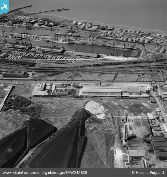
EAW045839 ENGLAND (1952). Royal Edward Dock Eastern Arm and the Fisons Ltd Fertilizer Works, Avonmouth, 1952. This image was marked by Aerofilms Ltd for photo editing.
© Copyright OpenStreetMap contributors and licensed by the OpenStreetMap Foundation. 2026. Cartography is licensed as CC BY-SA.
Nearby Images (16)
EAW045839

EAW045838

EAW045841

EAW045836

EAW045840

EAW045835

EAW045837

EAW045842

EAW045834

EAW045833

EAW049578

EAW049584

EPW019264

EAW049581

EAW002251

EAW049577

Details
| Title | [EAW045839] Royal Edward Dock Eastern Arm and the Fisons Ltd Fertilizer Works, Avonmouth, 1952. This image was marked by Aerofilms Ltd for photo editing. |
| Reference | EAW045839 |
| Date | 12-July-1952 |
| Link | |
| Place name | AVONMOUTH |
| Parish | |
| District | |
| Country | ENGLAND |
| Easting / Northing | 351859, 179221 |
| Longitude / Latitude | -2.693759872928, 51.509382392119 |
| National Grid Reference | ST519792 |
Pins


User Comment Contributions

North end of the Royal Edward Dock Eastern Arm looking west, taken from the St. Andrew's Road Station footbridge, Avonmouth, 31/03/2015 |

Class31 |
Wednesday 1st of April 2015 09:10:35 AM |