
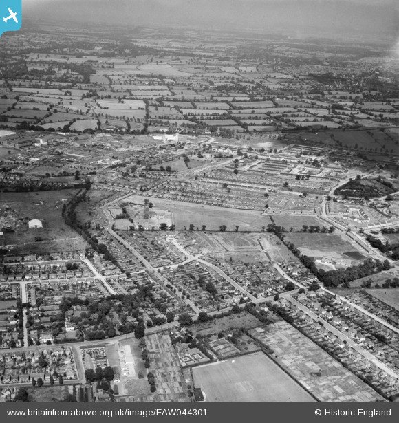
EAW044301 ENGLAND (1952). Hillside Avenue, Oakwood Avenue and environs, Borehamwood, from the south-west, 1952
© Copyright OpenStreetMap contributors and licensed by the OpenStreetMap Foundation. 2026. Cartography is licensed as CC BY-SA.
Nearby Images (2)
EAW044301

EPW021915

Details
| Title | [EAW044301] Hillside Avenue, Oakwood Avenue and environs, Borehamwood, from the south-west, 1952 |
| Reference | EAW044301 |
| Date | 24-June-1952 |
| Link | |
| Place name | BOREHAMWOOD |
| Parish | ELSTREE AND BOREHAMWOOD |
| District | |
| Country | ENGLAND |
| Easting / Northing | 519656, 196219 |
| Longitude / Latitude | -0.27019796247764, 51.651546419608 |
| National Grid Reference | TQ197962 |
Pins

Brian |
Wednesday 27th of May 2020 08:38:23 PM | |
|
Brian |
Wednesday 27th of May 2020 08:33:24 PM | |
|
Brian |
Wednesday 27th of May 2020 08:24:46 PM | |
|
Brian |
Wednesday 27th of May 2020 08:24:14 PM | |
|
Brian |
Wednesday 27th of May 2020 08:22:44 PM | |
|
Brian |
Wednesday 27th of May 2020 08:20:53 PM | |
|
Robin |
Tuesday 12th of May 2020 05:43:22 PM | |
|
Robin |
Tuesday 12th of May 2020 05:35:19 PM | |
|
Robin |
Tuesday 12th of May 2020 05:32:17 PM | |
|
Robin |
Tuesday 12th of May 2020 05:23:57 PM | |
|
Robin |
Tuesday 12th of May 2020 05:23:36 PM |