
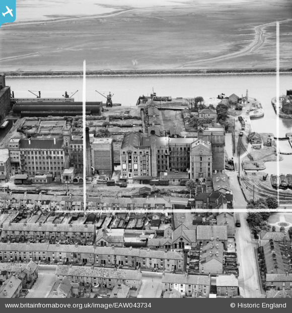
EAW043734 ENGLAND (1952). The Flour Mills on Lower Mersey Street, Ellesmere Port, 1952. This image was marked by Aerofilms Ltd for photo editing.
© Copyright OpenStreetMap contributors and licensed by the OpenStreetMap Foundation. 2026. Cartography is licensed as CC BY-SA.
Nearby Images (21)
EAW043734

EAW043731

EAW043738

EAW043732

EAW043735

EAW043730

EAW043733

EAW043737

EAW415732

EAW043736

EPW009276

EPW009278

EPW009275

EPW009274

EPW009279

EPW009280

EPW009281

EPW009277

EPW027826

EPW027975

EPW027828

Details
| Title | [EAW043734] The Flour Mills on Lower Mersey Street, Ellesmere Port, 1952. This image was marked by Aerofilms Ltd for photo editing. |
| Reference | EAW043734 |
| Date | 5-June-1952 |
| Link | |
| Place name | ELLESMERE PORT |
| Parish | |
| District | |
| Country | ENGLAND |
| Easting / Northing | 340298, 377314 |
| Longitude / Latitude | -2.8957006611258, 53.289150218563 |
| National Grid Reference | SJ403773 |
Pins
Be the first to add a comment to this image!