
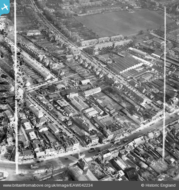
EAW042234 ENGLAND (1952). The Dunbar Cooperage off the High Road, Tottenham, 1952. This image has been produced from a damaged negative.
© Copyright OpenStreetMap contributors and licensed by the OpenStreetMap Foundation. 2026. Cartography is licensed as CC BY-SA.
Nearby Images (11)
EAW042234

EAW042230

EAW042239

EAW042237

EAW042235

EAW042233

EAW042236

EAW042240

EAW042231

EAW042232

EAW042238

Details
| Title | [EAW042234] The Dunbar Cooperage off the High Road, Tottenham, 1952. This image has been produced from a damaged negative. |
| Reference | EAW042234 |
| Date | 7-April-1952 |
| Link | |
| Place name | TOTTENHAM |
| Parish | |
| District | |
| Country | ENGLAND |
| Easting / Northing | 533988, 191562 |
| Longitude / Latitude | -0.064910797047694, 51.606459684238 |
| National Grid Reference | TQ340916 |
Pins

John Wass |
Saturday 25th of April 2015 03:13:48 PM | |

Class31 |
Sunday 30th of November 2014 12:48:48 PM | |
|
Class31 |
Sunday 30th of November 2014 12:35:01 PM | |
|
Ray Flack |
Wednesday 1st of October 2014 11:39:59 AM | |
|
Ray Flack |
Wednesday 1st of October 2014 11:28:43 AM | |
 |
Ray Flack |
Wednesday 1st of October 2014 11:26:37 AM |
 |
Ray Flack |
Wednesday 1st of October 2014 11:13:21 AM |
|
Ray Flack |
Wednesday 1st of October 2014 11:08:45 AM | |
|
Ray Flack |
Wednesday 1st of October 2014 11:07:58 AM | |
|
Ray Flack |
Wednesday 1st of October 2014 11:07:33 AM | |
|
Ray Flack |
Wednesday 1st of October 2014 11:06:14 AM |


