
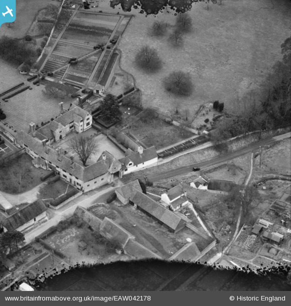
EAW042178 ENGLAND (1952). Frogmore Lane and The Manor, Long Crendon, 1952. This image has been produced from a damaged negative.
© Copyright OpenStreetMap contributors and licensed by the OpenStreetMap Foundation. 2026. Cartography is licensed as CC BY-SA.
Nearby Images (5)
EAW042178

EAW042189

EAW042190

EAW042179

EAW042191

Details
| Title | [EAW042178] Frogmore Lane and The Manor, Long Crendon, 1952. This image has been produced from a damaged negative. |
| Reference | EAW042178 |
| Date | 3-April-1952 |
| Link | |
| Place name | LONG CRENDON |
| Parish | LONG CRENDON |
| District | |
| Country | ENGLAND |
| Easting / Northing | 469281, 208504 |
| Longitude / Latitude | -0.99583515187777, 51.770466413425 |
| National Grid Reference | SP693085 |
Pins
Be the first to add a comment to this image!