
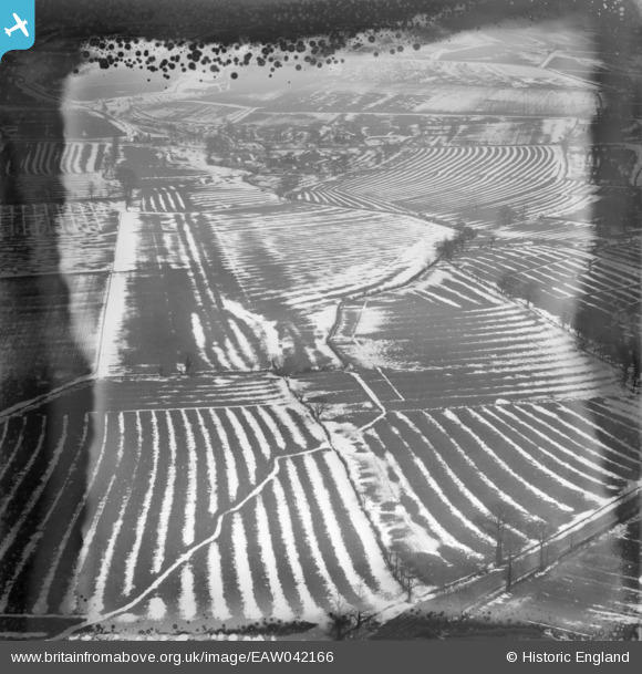
EAW042166 ENGLAND (1952). Snow in the fields around Medbourne Farm, Medbourne, 1952. This image has been produced from a damaged negative.
© Copyright OpenStreetMap contributors and licensed by the OpenStreetMap Foundation. 2026. Cartography is licensed as CC BY-SA.
Nearby Images (3)
EAW042166

EAW042167

EAW042169

Details
| Title | [EAW042166] Snow in the fields around Medbourne Farm, Medbourne, 1952. This image has been produced from a damaged negative. |
| Reference | EAW042166 |
| Date | 31-March-1952 |
| Link | |
| Place name | MEDBOURNE |
| Parish | LIDDINGTON |
| District | |
| Country | ENGLAND |
| Easting / Northing | 419617, 181571 |
| Longitude / Latitude | -1.7171592698174, 51.532225249044 |
| National Grid Reference | SU196816 |
Pins
Be the first to add a comment to this image!