
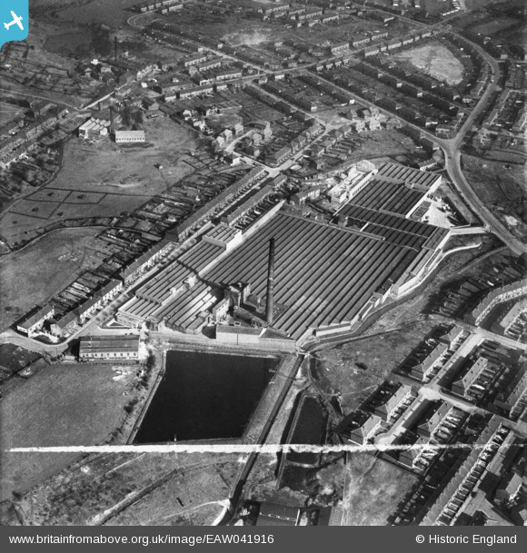
EAW041916 ENGLAND (1952). Cromer Ring Cotton Mill, Middleton, 1952. This image was marked by Aerofilms Ltd for photo editing.
© Copyright OpenStreetMap contributors and licensed by the OpenStreetMap Foundation. 2026. Cartography is licensed as CC BY-SA.
Nearby Images (11)
EAW041916

EAW041922

EPW017290

EAW041913

EAW041919

EAW041920

EAW041918

EAW041917

EAW041921

EAW041915

EAW041914

Details
| Title | [EAW041916] Cromer Ring Cotton Mill, Middleton, 1952. This image was marked by Aerofilms Ltd for photo editing. |
| Reference | EAW041916 |
| Date | 15-March-1952 |
| Link | |
| Place name | MIDDLETON |
| Parish | |
| District | |
| Country | ENGLAND |
| Easting / Northing | 387689, 406312 |
| Longitude / Latitude | -2.185845324332, 53.553048841982 |
| National Grid Reference | SD877063 |
Pins
Be the first to add a comment to this image!