
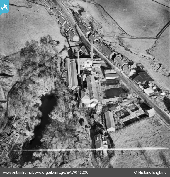
EAW041200 ENGLAND (1951). The Fothergill and Harvey Ltd Mill off Todmorden Road, Gale, 1951. This image was marked by Aerofilms Ltd for photo editing.
© Copyright OpenStreetMap contributors and licensed by the OpenStreetMap Foundation. 2026. Cartography is licensed as CC BY-SA.
Nearby Images (16)
EAW041200

EAW041197

EAW041196

EAW039766

EAW041199

EAW039767

EAW041194

EAW039768

EAW039765

EAW039771

EAW041193

EAW041195

EAW039770

EAW041198

EAW039769

EAW041201

Details
| Title | [EAW041200] The Fothergill and Harvey Ltd Mill off Todmorden Road, Gale, 1951. This image was marked by Aerofilms Ltd for photo editing. |
| Reference | EAW041200 |
| Date | 31-October-1951 |
| Link | |
| Place name | GALE |
| Parish | |
| District | |
| Country | ENGLAND |
| Easting / Northing | 394178, 417250 |
| Longitude / Latitude | -2.0880927307262, 53.651485858736 |
| National Grid Reference | SD942173 |
Pins
Be the first to add a comment to this image!