
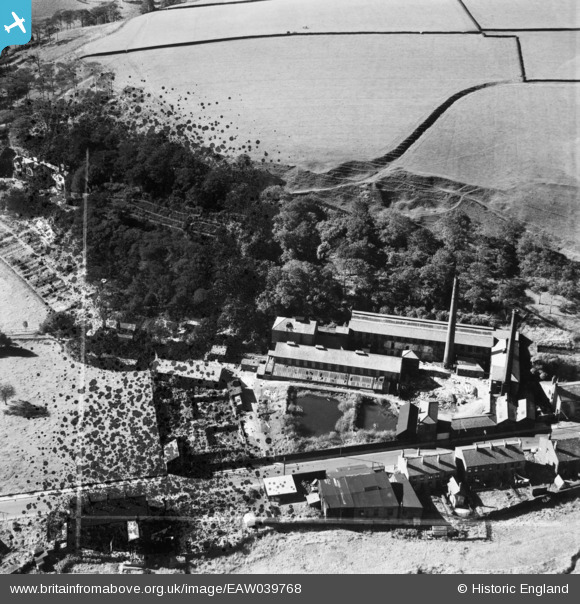
EAW039768 ENGLAND (1951). Fothergill and Harvey Ltd Gale Mill, Gale, 1951. This image has been produced from a damaged negative.
© Copyright OpenStreetMap contributors and licensed by the OpenStreetMap Foundation. 2026. Cartography is licensed as CC BY-SA.
Nearby Images (16)
EAW039768

EAW039765

EAW039771

EAW041193

EAW041199

EAW039767

EAW039770

EAW041197

EAW041196

EAW039766

EAW041194

EAW041198

EAW041195

EAW041200

EAW039769

EAW041201

Details
| Title | [EAW039768] Fothergill and Harvey Ltd Gale Mill, Gale, 1951. This image has been produced from a damaged negative. |
| Reference | EAW039768 |
| Date | 15-September-1951 |
| Link | |
| Place name | GALE |
| Parish | |
| District | |
| Country | ENGLAND |
| Easting / Northing | 394148, 417251 |
| Longitude / Latitude | -2.0885466792167, 53.651494513144 |
| National Grid Reference | SD941173 |
Pins
Be the first to add a comment to this image!