
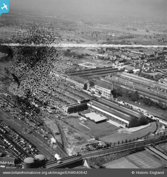
EAW040642 ENGLAND (1951). The Kelsey-Hayes Car Wheel Manufactory and environs, Dagenham, from the south-east, 1951. This image has been produced from a damaged negative.
© Copyright OpenStreetMap contributors and licensed by the OpenStreetMap Foundation. 2026. Cartography is licensed as CC BY-SA.
Nearby Images (24)
EAW040642

EAW026154

EAW040641

EAW040643

EAW040645

EAW026149

EAW040644

EAW026148

EAW026152

EAW026150

EAW026147

EAW040647

EAW040640

EPW037321

EAW026153

EAW016634

EAW016632

EAW043575

EAW016636

EAW052716

EAW052717

EAW016635

EPW037320

EAW016633

Details
| Title | [EAW040642] The Kelsey-Hayes Car Wheel Manufactory and environs, Dagenham, from the south-east, 1951. This image has been produced from a damaged negative. |
| Reference | EAW040642 |
| Date | 12-October-1951 |
| Link | |
| Place name | DAGENHAM |
| Parish | |
| District | |
| Country | ENGLAND |
| Easting / Northing | 549358, 183039 |
| Longitude / Latitude | 0.15328378546525, 51.526004320612 |
| National Grid Reference | TQ494830 |
Pins
Be the first to add a comment to this image!