
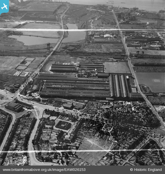
EAW026153 ENGLAND (1949). The Kelsey-Hayes Car Wheel Manufactory and the Briggs Car Body Manufactory, Dagenham, 1949. This image has been produced from a damaged negative.
© Copyright OpenStreetMap contributors and licensed by the OpenStreetMap Foundation. 2026. Cartography is licensed as CC BY-SA.
Nearby Images (39)
EAW026153

EAW016634

EAW016632

EAW016636

EAW026159

EAW052718

EAW026157

EAW016637

EAW052714

EAW052722

EAW016635

EAW026151

EAW052721

EAW026155

EAW040647

EAW052716

EPW037321

EAW016633

EAW026148

EAW026156

EAW040644

EAW052715

EAW040640

EAW026152

EAW026149

EAW052717

EAW026150

EAW016638

EAW026147

EPW037320

EAW040645

EAW040643

EAW026154

EAW040641

EAW052719

EAW052720

EAW040642

EAW026138

EAW026158

Details
| Title | [EAW026153] The Kelsey-Hayes Car Wheel Manufactory and the Briggs Car Body Manufactory, Dagenham, 1949. This image has been produced from a damaged negative. |
| Reference | EAW026153 |
| Date | 16-August-1949 |
| Link | |
| Place name | DAGENHAM |
| Parish | |
| District | |
| Country | ENGLAND |
| Easting / Northing | 549293, 183253 |
| Longitude / Latitude | 0.15243811108433, 51.527944539162 |
| National Grid Reference | TQ493833 |
Pins
Be the first to add a comment to this image!