
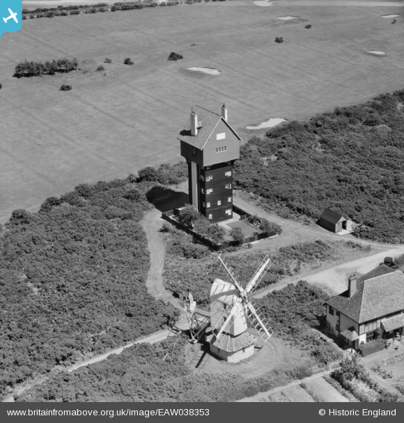
EAW038353 ENGLAND (1951). The House in the Clouds and Thorpeness Windmill, Thorpeness, 1951
© Copyright OpenStreetMap contributors and licensed by the OpenStreetMap Foundation. 2026. Cartography is licensed as CC BY-SA.
Nearby Images (6)
EAW038353

EAW038306

EAW038352

EAW038305

EAW038336

EPW001910

Details
| Title | [EAW038353] The House in the Clouds and Thorpeness Windmill, Thorpeness, 1951 |
| Reference | EAW038353 |
| Date | 3-August-1951 |
| Link | |
| Place name | THORPENESS |
| Parish | ALDRINGHAM CUM THORPE |
| District | |
| Country | ENGLAND |
| Easting / Northing | 646848, 259875 |
| Longitude / Latitude | 1.6112672424099, 52.181382556863 |
| National Grid Reference | TM468599 |
Pins
Be the first to add a comment to this image!