
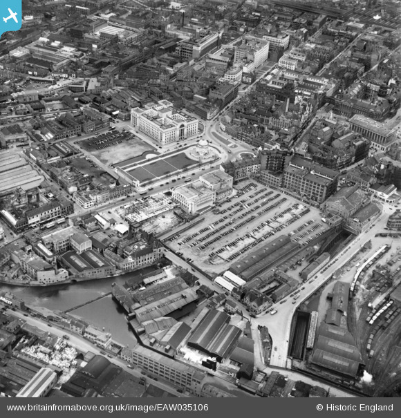
EAW035106 ENGLAND (1951). Broad Street and environs, Birmingham, 1951
© Copyright OpenStreetMap contributors and licensed by the OpenStreetMap Foundation. 2026. Cartography is licensed as CC BY-SA.
Nearby Images (20)
EAW035106

EAW031628

EAW035105

EPW041474

EPW038602

EPW037054

EAW013565

EPW038600

EPW048092

EAW026250

EPW048091

EPW054234

EPW005846

EAW013564

EPW048535

EAW026251

EPW048534

EPW005850

EPW022585

EPW022584

Details
| Title | [EAW035106] Broad Street and environs, Birmingham, 1951 |
| Reference | EAW035106 |
| Date | 21-March-1951 |
| Link | |
| Place name | BIRMINGHAM |
| Parish | |
| District | |
| Country | ENGLAND |
| Easting / Northing | 406375, 286722 |
| Longitude / Latitude | -1.9061262787407, 52.478018614613 |
| National Grid Reference | SP064867 |
Pins


User Comment Contributions

The Hall of Memory, Birmingham, 09/08/2014 |

Class31 |
Wednesday 13th of May 2015 07:01:31 AM |

The Hall of Memory, Birmingham, 09/08/2014 |
Class31 |
Wednesday 13th of May 2015 07:00:44 AM |

This is where Centenary Square and the Library of Birmingham are now! |
Aisha Hamis |
Tuesday 17th of June 2014 04:08:55 PM |

Woolly plane flying over Centenary Square |
Aisha Hamis |
Tuesday 17th of June 2014 04:08:55 PM |