
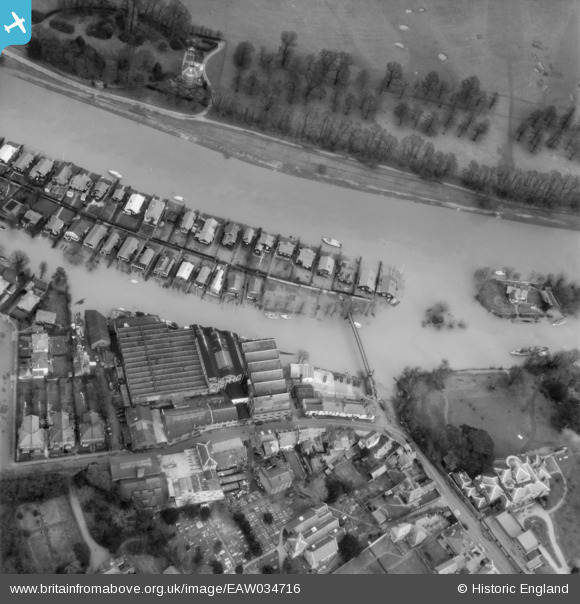
EAW034716 ENGLAND (1951). The River Thames in flood at Thames Ditton Island, Thames Ditton, 1951
© Copyright OpenStreetMap contributors and licensed by the OpenStreetMap Foundation. 2026. Cartography is licensed as CC BY-SA.
Nearby Images (11)
EAW034716

EAW034748

EPW009432

EPW009429

EAW003679

EPW009428

EPW009430

EPW009435

EPW009434

EPW009433

EPW009431

Details
| Title | [EAW034716] The River Thames in flood at Thames Ditton Island, Thames Ditton, 1951 |
| Reference | EAW034716 |
| Date | 21-March-1951 |
| Link | |
| Place name | THAMES DITTON |
| Parish | |
| District | |
| Country | ENGLAND |
| Easting / Northing | 516201, 167373 |
| Longitude / Latitude | -0.32963738284157, 51.39298541749 |
| National Grid Reference | TQ162674 |
Pins

hurricane500 |
Monday 18th of June 2018 10:35:42 PM |