
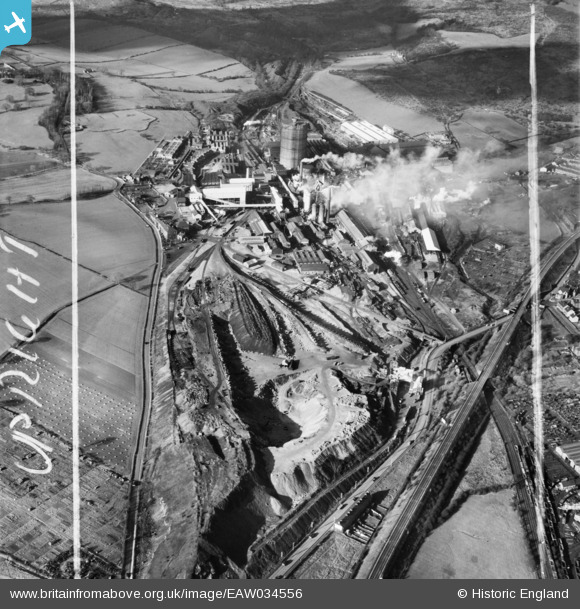
EAW034556 ENGLAND (1951). The Sheepbridge Iron Works, Sheepbridge, 1951. This image was marked by Aerofilms Ltd for photo editing.
© Copyright OpenStreetMap contributors and licensed by the OpenStreetMap Foundation. 2026. Cartography is licensed as CC BY-SA.
Nearby Images (18)
EAW034556

EAW034555

EAW017307

EAW034559

EAW034557

EAW034553

EAW034551

EAW017309

EPW048952

EPW048956

EPW048954

EPW048955

EAW034567

EPW048957

EAW034552

EAW034554

EAW017308

EAW017311

Details
| Title | [EAW034556] The Sheepbridge Iron Works, Sheepbridge, 1951. This image was marked by Aerofilms Ltd for photo editing. |
| Reference | EAW034556 |
| Date | 6-February-1951 |
| Link | |
| Place name | SHEEPBRIDGE |
| Parish | |
| District | |
| Country | ENGLAND |
| Easting / Northing | 437523, 374531 |
| Longitude / Latitude | -1.4373535938421, 53.266167448652 |
| National Grid Reference | SK375745 |
Pins

RichardL |
Monday 13th of October 2014 07:57:15 AM |