
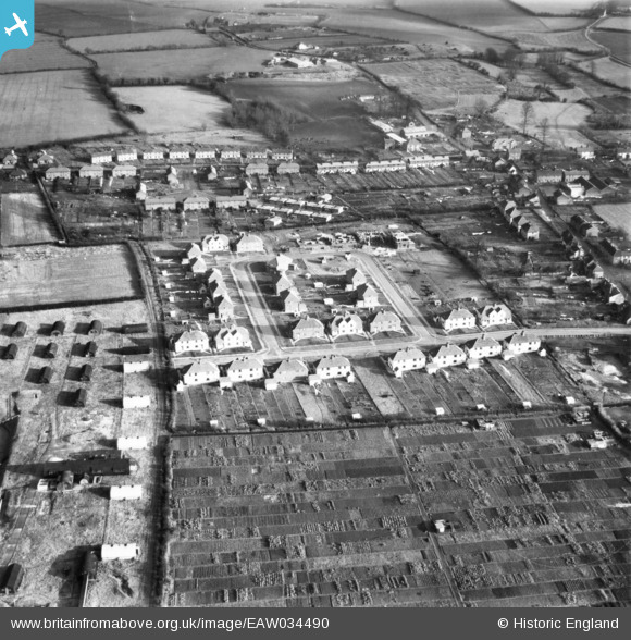
EAW034490 ENGLAND (1951). Bradfield Avenue, Bradfield Crescent and environs, Hadleigh, 1951. This image has been produced from a print.
© Copyright OpenStreetMap contributors and licensed by the OpenStreetMap Foundation. 2026. Cartography is licensed as CC BY-SA.
Nearby Images (9)
EAW034490

EAW034485

EAW034484

EAW034489

EAW034488

EAW034491

EAW034486

EAW034487

EAW034483

Details
| Title | [EAW034490] Bradfield Avenue, Bradfield Crescent and environs, Hadleigh, 1951. This image has been produced from a print. |
| Reference | EAW034490 |
| Date | 15-January-1951 |
| Link | |
| Place name | HADLEIGH |
| Parish | HADLEIGH |
| District | |
| Country | ENGLAND |
| Easting / Northing | 602930, 243026 |
| Longitude / Latitude | 0.9597552151408, 52.047994533638 |
| National Grid Reference | TM029430 |
Pins

Matt Aldred edob.mattaldred.com |
Friday 6th of September 2024 02:51:08 PM |