
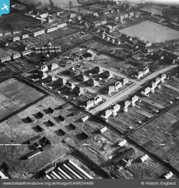
EAW034488 ENGLAND (1951). Bradfield Crescent, Hadleigh, 1951. This image has been produced from a print marked by Aerofilms Ltd for photo editing.
© Copyright OpenStreetMap contributors and licensed by the OpenStreetMap Foundation. 2026. Cartography is licensed as CC BY-SA.
Nearby Images (9)
EAW034488

EAW034487

EAW034490

EAW034491

EAW034485

EAW034484

EAW034489

EAW034486

EAW034483

Details
| Title | [EAW034488] Bradfield Crescent, Hadleigh, 1951. This image has been produced from a print marked by Aerofilms Ltd for photo editing. |
| Reference | EAW034488 |
| Date | 15-January-1951 |
| Link | |
| Place name | HADLEIGH |
| Parish | HADLEIGH |
| District | |
| Country | ENGLAND |
| Easting / Northing | 602907, 243043 |
| Longitude / Latitude | 0.95943033480081, 52.048155607689 |
| National Grid Reference | TM029430 |
Pins
Be the first to add a comment to this image!