
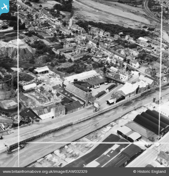
EAW032329 ENGLAND (1950). Frank Pertwee and Sons Ltd Granaries off Hythe Quay and Hythe Hill, Colchester, 1950. This image was marked by Aerofilms Ltd for photo editing.
© Copyright OpenStreetMap contributors and licensed by the OpenStreetMap Foundation. 2026. Cartography is licensed as CC BY-SA.
Nearby Images (22)
EAW032329

EAW032319

EAW032320

EAW032317

EAW032332

EAW032333

EAW032318

EAW032316

EAW032324

EAW032328

EAW032325

EAW032331

EAW032327

EAW032334

EAW032323

EAW032335

EAW032321

EAW032322

EAW032326

EAW032330

EPW046368

EPW046370

Details
| Title | [EAW032329] Frank Pertwee and Sons Ltd Granaries off Hythe Quay and Hythe Hill, Colchester, 1950. This image was marked by Aerofilms Ltd for photo editing. |
| Reference | EAW032329 |
| Date | 6-September-1950 |
| Link | |
| Place name | COLCHESTER |
| Parish | |
| District | |
| Country | ENGLAND |
| Easting / Northing | 601465, 224567 |
| Longitude / Latitude | 0.92758916481731, 51.882767063848 |
| National Grid Reference | TM015246 |
Pins

Matt Aldred edob.mattaldred.com |
Thursday 18th of February 2021 05:28:28 PM | |

HAJ |
Wednesday 7th of May 2014 02:21:47 PM |