
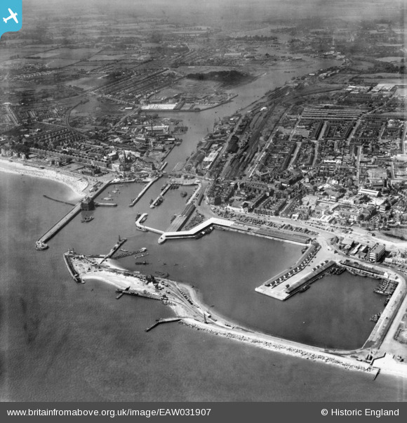
EAW031907 ENGLAND (1950). The docks, Lowestoft, 1950
© Copyright OpenStreetMap contributors and licensed by the OpenStreetMap Foundation. 2026. Cartography is licensed as CC BY-SA.
Nearby Images (12)
EAW031907

EAR032727

EAW052978

EAW031909

EAW005064

EAW047642

EAW005063

EAW047641

EPW021250

EAW052979

EAW031906

EAW025475

Details
| Title | [EAW031907] The docks, Lowestoft, 1950 |
| Reference | EAW031907 |
| Date | 14-August-1950 |
| Link | |
| Place name | LOWESTOFT |
| Parish | |
| District | |
| Country | ENGLAND |
| Easting / Northing | 655006, 292843 |
| Longitude / Latitude | 1.7553418449008, 52.473463246577 |
| National Grid Reference | TM550928 |
Pins

Brightonboy |
Wednesday 25th of June 2014 07:45:35 AM | |
|
Brightonboy |
Wednesday 25th of June 2014 07:43:02 AM | |
|
Brightonboy |
Wednesday 25th of June 2014 07:40:58 AM | |
|
Brightonboy |
Wednesday 25th of June 2014 07:39:33 AM |