
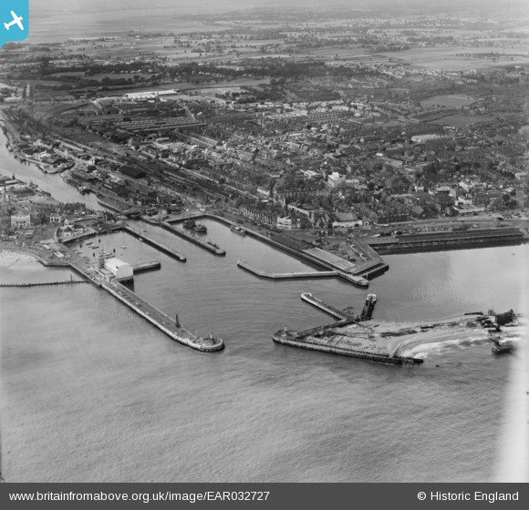
EAR032727 ENGLAND (1958). Outer Harbour and Waveney Dock, Lowestoft, 1958
© Copyright OpenStreetMap contributors and licensed by the OpenStreetMap Foundation. 2026. Cartography is licensed as CC BY-SA.
Nearby Images (14)
EAR032727

EAW052978

EAW031907

EAW031909

EAW047641

EPW021250

EAW005064

EAW047642

EAW031908

EAW052979

EAW005063

EAW031906

EAW025475

EPW021242

Details
| Title | [EAR032727] Outer Harbour and Waveney Dock, Lowestoft, 1958 |
| Reference | EAR032727 |
| Date | 15-May-1958 |
| Link | |
| Place name | LOWESTOFT |
| Parish | NON CIVIL PARISH |
| District | |
| Country | ENGLAND |
| Easting / Northing | 654955, 292847 |
| Longitude / Latitude | 1.7545956046723, 52.473522949165 |
| National Grid Reference | TM550928 |
Pins

Brightonboy |
Friday 29th of January 2021 09:33:29 PM | |
|
cptpies |
Friday 15th of November 2019 12:29:28 PM |