
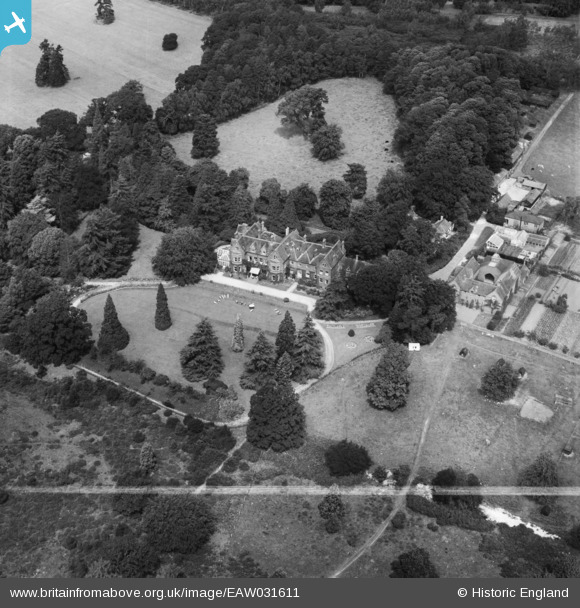
EAW031611 ENGLAND (1950). Enton Hall Health Hydro, Witley, 1950. This image was marked by Aerofilms Ltd for photo editing.
© Copyright OpenStreetMap contributors and licensed by the OpenStreetMap Foundation. 2025. Cartography is licensed as CC BY-SA.
Nearby Images (33)
EAW031611

EAW036633

EAW033388

EAW036630

EAW033389

EAW036639

EAW036631

EAW036634

EAW036638

EAW033387

EAW036629

EAW031613

EAW033396

EAW036636

EAW031610

EAW031609

EAW036632

EAW033395

EAW036637

EAW031560

EAW031612

EAW033393

EAW033397

EAW036635

EAW033391

EAW031615

EAW031614

EAW033394

EAW033392

EAW033398

EAW033390

EAW031617

EAW031616

Details
| Title | [EAW031611] Enton Hall Health Hydro, Witley, 1950. This image was marked by Aerofilms Ltd for photo editing. |
| Reference | EAW031611 |
| Date | 1-August-1950 |
| Link | |
| Place name | WITLEY |
| Parish | WITLEY |
| District | |
| Country | ENGLAND |
| Easting / Northing | 495605, 139278 |
| Longitude / Latitude | -0.63311458135547, 51.144248697402 |
| National Grid Reference | SU956393 |
Pins
Be the first to add a comment to this image!