
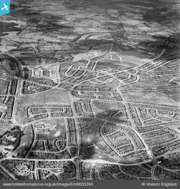
EAW031393 ENGLAND (1950). Suburban development at Parson Cross, Sheffield, 1950
© Copyright OpenStreetMap contributors and licensed by the OpenStreetMap Foundation. 2025. Cartography is licensed as CC BY-SA.
Nearby Images (4)
EAW031393

EAW031390

EAW031392

EAW031391

Details
| Title | [EAW031393] Suburban development at Parson Cross, Sheffield, 1950 |
| Reference | EAW031393 |
| Date | 26-July-1950 |
| Link | |
| Place name | SHEFFIELD |
| Parish | |
| District | |
| Country | ENGLAND |
| Easting / Northing | 434477, 392462 |
| Longitude / Latitude | -1.4810717298104, 53.427561788707 |
| National Grid Reference | SK345925 |
Pins

martinmj |
Wednesday 13th of July 2022 08:28:56 PM | |
|
redmist |
Thursday 17th of January 2019 11:48:08 PM | |
|
redmist |
Thursday 17th of January 2019 11:47:39 PM | |
|
CrossMan |
Sunday 12th of February 2017 02:50:33 PM |