
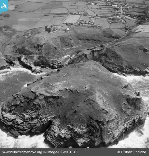
EAW031046 ENGLAND (1950). Tintagel Island, Tintagel, 1950
© Copyright OpenStreetMap contributors and licensed by the OpenStreetMap Foundation. 2026. Cartography is licensed as CC BY-SA.
Nearby Images (17)
EAW031046

EAW031043

EAW005832

EAW005830

EAW031041

EAW005828

EAW031039

EAW031042

EAW031040

EAW031045

EAW031044

EAW020264

EAW005831

EAW005829

EAW031019

EAW031015

EAW005833

Details
| Title | [EAW031046] Tintagel Island, Tintagel, 1950 |
| Reference | EAW031046 |
| Date | 11-July-1950 |
| Link | |
| Place name | TINTAGEL |
| Parish | TINTAGEL |
| District | |
| Country | ENGLAND |
| Easting / Northing | 204958, 89099 |
| Longitude / Latitude | -4.7604191987281, 50.668260195648 |
| National Grid Reference | SX050891 |
Pins

Andy Burton |
Thursday 24th of July 2014 02:50:53 PM |