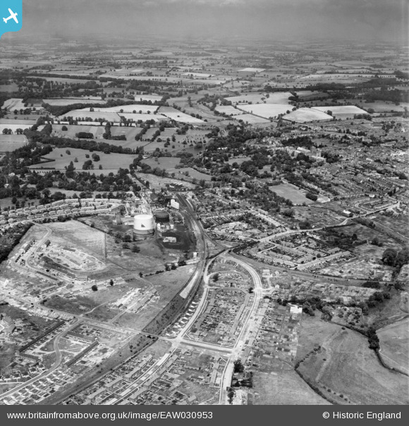
EAW030953 ENGLAND (1950). The Gas Works, Abbey Station the area around Sotwell Nunnery, St Albans, from the south-east, 1950
    © Copyright OpenStreetMap contributors and licensed by the OpenStreetMap Foundation. 2025. Cartography is licensed as CC BY-SA.
  
Details
| Title | [EAW030953] The Gas Works, Abbey Station the area around Sotwell Nunnery, St Albans, from the south-east, 1950 | 
| Reference | EAW030953 | 
| Date | 13-July-1950 | 
| Link | |
| Place name | ST ALBANS | 
| Parish | |
| District | |
| Country | ENGLAND | 
| Easting / Northing | 514956, 205967 | 
| Longitude / Latitude | -0.33489858759174, 51.74014636542 | 
| National Grid Reference | TL150060 | 
Pins
|  Sopwell Mill |   Sandyn | Saturday 21st of August 2021 04:48:22 PM | 
 
             
  ![[EAW030953] The Gas Works, Abbey Station the area around Sotwell Nunnery, St Albans, from the south-east, 1950](http://britainfromabove.org.uk/sites/all/libraries/aerofilms-images/public/100x100/EAW/030/EAW030953.jpg) 
  
                                          ![[EAW041251] The Gas Works and development of housing at Maynard Drive and Berners Drive, Sopwell, 1951](http://britainfromabove.org.uk/sites/all/libraries/aerofilms-images/public/100x100/EAW/041/EAW041251.jpg) 
 ![[EAW030951] The Gas Works, Abbey Station and Verulamium Park, St Albans, from the south-east, 1950](http://britainfromabove.org.uk/sites/all/libraries/aerofilms-images/public/100x100/EAW/030/EAW030951.jpg) 
 ![[EAW030232] St Julian's and the city, St Albans, 1950](http://britainfromabove.org.uk/sites/all/libraries/aerofilms-images/public/100x100/EAW/030/EAW030232.jpg)